Assembling route information from all the UK's private rail operators into one large collection for easy reference. Each map is build around one or more 'focus' stations, and includes connections for other forms of transportation.
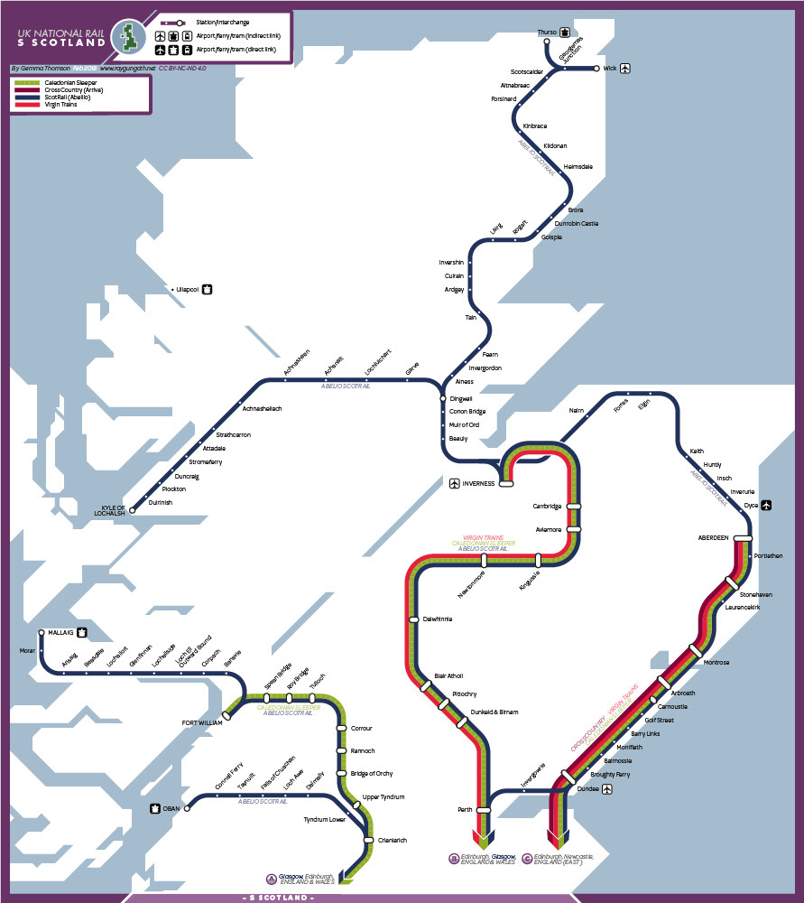
Northern Scotland features a much less dense set of railways and stations, and so sits at a different zoom factor. My primary goal here was to fit the abstracted lines to a recognisable coastline, as geography becomes a more useful point of reference at this scale than for the following, more urban maps.
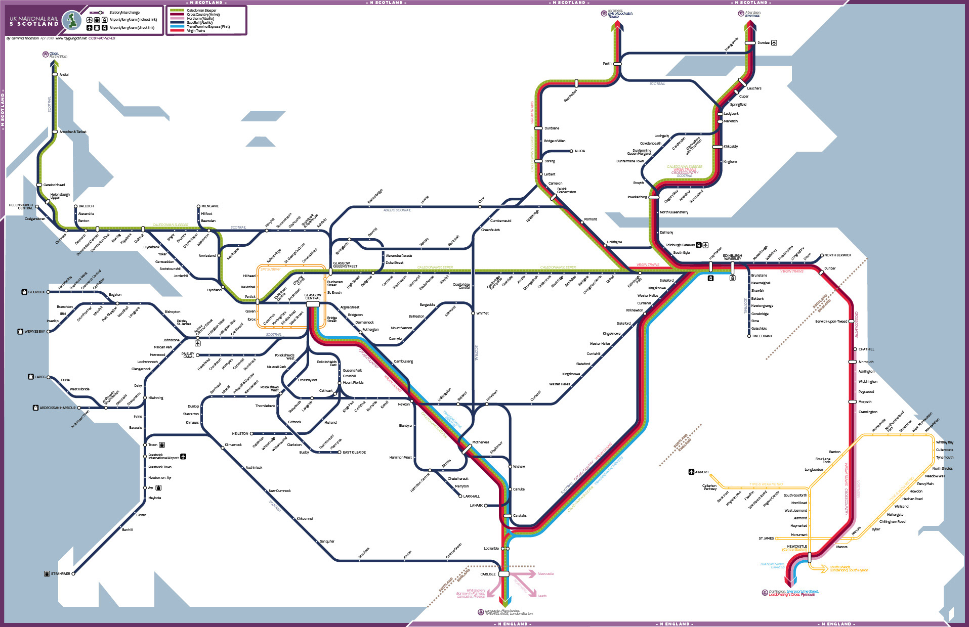
South-western Scotland features Glasgow Central as its hub, and so the first iteration of this region involved a south-east/south-west split. However, the hub of Edinburgh was joined on afterwards in order to more easily accommodate the tip of Northumberland in this rectangular presentation.
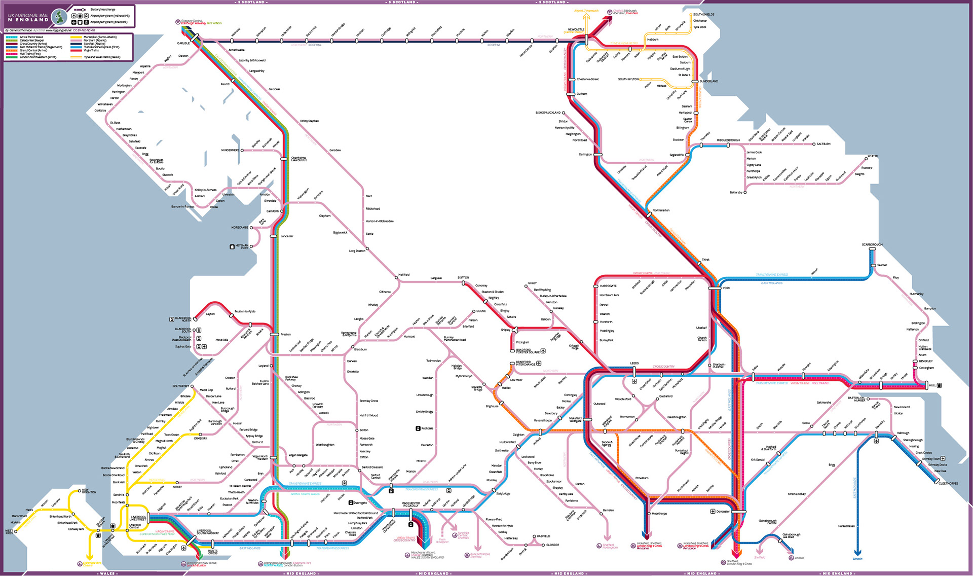
Northern England quickly became the largest map drawn to date, as the initial cut-off points of Preston and Bradford left the map with a disproportionate amount of white space, and some particularly complicated lines being left to continue on other sections. The wilderness of the North Pennines remains obvious in the top centre of this map, however I endeavoured to balance this amongst the surrounding network, which includes the world's very first passenger railways.